
Geospatial Technology: Revolutionizing Civil Engineering
In the realm of civil engineering, the integration of geospatial technology has ushered in a new era of innovation and efficiency, fundamentally transforming the way projects are planned, designed, and executed. Geospatial technology encompasses a diverse array of tools and techniques for capturing, analyzing, and visualizing geographic data, providing engineers with invaluable insights into the complex interplay between the built environment and the natural landscape.
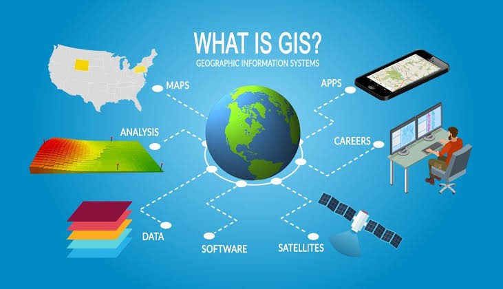
At the heart of geospatial technology lies Geographic Information Systems (GIS), powerful software platforms that enable engineers to organize, manipulate, and interpret spatial data with unprecedented precision. Through the integration of various data sources – including satellite imagery, aerial surveys, and ground-based sensors – GIS allows for the creation of comprehensive, multi-layered maps that serve as the foundation for informed decision-making in civil engineering projects.
One of the primary applications of geospatial technology in civil engineering lies in the realm of site selection and land use planning. By leveraging GIS capabilities, engineers can conduct detailed analyses of terrain characteristics, environmental constraints, and infrastructure availability to identify optimal locations for development projects. Whether it’s siting a new highway, locating a water treatment facility, or planning a residential subdivision, GIS provides the analytical tools necessary to assess the suitability of potential sites and mitigate potential risks.
In the realm of civil engineering, the integration of geospatial technology has ushered in a new era of innovation and efficiency, fundamentally transforming the way projects are planned, designed, and executed. Geospatial technology encompasses a diverse array of tools and techniques for capturing, analyzing, and visualizing geographic data, providing engineers with invaluable insights into the complex interplay between the built environment and the natural landscape.
One of the primary applications of geospatial technology in civil engineering lies in the realm of site selection and land use planning. By leveraging GIS capabilities, engineers can conduct detailed analyses of terrain characteristics, environmental constraints, and infrastructure availability to identify optimal locations for development projects. Whether it’s siting a new highway, locating a water treatment facility, or planning a residential subdivision, GIS provides the analytical tools necessary to assess the suitability of potential sites and mitigate potential risks.
Moreover, geospatial technology enhances the resilience of civil infrastructure against natural hazards and climate change. Through advanced modeling and simulation techniques, engineers can assess the vulnerability of critical infrastructure – such as bridges, levees, and utility networks – to events such as floods, earthquakes, and sea-level rise. By incorporating geospatial data into risk assessment and mitigation strategies, engineers can design infrastructure that is better able to withstand extreme events and adapt to changing environmental conditions, thereby enhancing the safety and sustainability of our built environment.
Additionally, geospatial technology aids in asset management and maintenance of civil infrastructure. By creating detailed inventories of assets such as roads, bridges, and pipelines using GIS, engineers can develop proactive maintenance plans, optimize resource allocation, and extend the lifespan of critical infrastructure. Furthermore, GIS-enabled asset management systems facilitate data-driven decision-making by providing insights into the condition, performance, and lifecycle costs of infrastructure assets over time.
Furthermore, geospatial technology plays a crucial role in the design and construction phases of civil engineering projects. By overlaying design plans onto georeferenced maps, engineers can visualize how proposed structures will interact with the surrounding landscape, enabling them to optimize layouts, minimize environmental impacts, and ensure regulatory compliance. Additionally, GIS facilitates real-time monitoring and quality control during construction, allowing project managers to track progress, detect deviations from specifications, and address issues proactively to avoid costly delays
Moreover, geospatial technology enhances the resilience of civil infrastructure against natural hazards and climate change. Through advanced modeling and simulation techniques, engineers can assess the vulnerability of critical infrastructure – such as bridges, levees, and utility networks – to events such as floods, earthquakes, and sea-level rise. By incorporating geospatial data into risk assessment and mitigation strategies, engineers can design infrastructure that is better able to withstand extreme events and adapt to changing environmental conditions, thereby enhancing the safety and sustainability of our built environment.
In conclusion, geospatial technology has emerged as a game-changer in the field of civil engineering, empowering engineers to tackle complex challenges with unprecedented precision and efficiency. From site selection and design optimization to construction monitoring and risk assessment, GIS and other geospatial tools have become indispensable assets in the engineer’s toolkit, enabling the creation of resilient, sustainable, and liveable communities. As technology continues to evolve and new applications emerge, the role of geospatial technology in civil engineering will only continue to grow, driving innovation and shaping the future of our built environment.