

Introduction:
In recent years, drones have emerged as powerful tools in the field of civil engineering, offering unprecedented capabilities for surveying, mapping, inspection, and monitoring of construction projects. These versatile unmanned aerial vehicles (UAVs) are transforming traditional methods of project management and site analysis, enabling engineers to gather real-time data, improve efficiency, and enhance safety. In this blog post, we delve into the multifaceted role of drones in civil engineering projects and explore their impact on the industry.
Enhanced Surveying and Mapping:
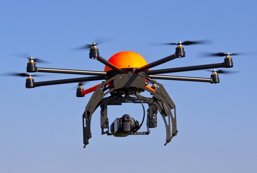
One of the primary applications of drones in civil engineering is surveying and mapping. Equipped with high-resolution cameras, LiDAR sensors, and GPS technology, drones can capture detailed aerial imagery and topographic data with unparalleled accuracy and efficiency. By rapidly collecting data over large areas, drones enable engineers to create precise 3D models, digital terrain maps, and orthophotos, facilitating site analysis, earthwork calculations, and design optimization.
Efficient Site Inspection and Monitoring:
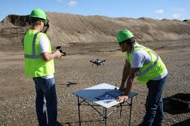
Drones are revolutionizing the way construction sites are inspected and monitored throughout the project lifecycle. Instead of relying on manual inspections or cumbersome equipment such as scaffolding and cranes, engineers can deploy drones to conduct aerial surveys and inspections quickly and safely. Drones equipped with thermal cameras and sensors can detect structural defects, identify safety hazards, and assess the integrity of buildings, bridges, and infrastructure, allowing for timely intervention and maintenance.
Cost-Effective Asset Management:
With their ability to capture detailed imagery and data from inaccessible or hazardous areas, drones offer significant cost savings and efficiencies in asset management and maintenance. By performing routine inspections and condition assessments, drones help identify potential issues before they escalate, minimizing downtime, repair costs, and disruptions to operations. Additionally, drones can facilitate inventory management, stockpile measurements, and asset tracking in industries such as mining, utilities, and transportation.
Safety and Risk Mitigation:
Safety is paramount in civil engineering projects, and drones play a crucial role in mitigating risks associated with hazardous environments and complex structures. By providing a bird’s-eye view of construction sites and infrastructure, drones enable engineers to identify safety hazards, monitor worksite activities, and ensure compliance with safety regulations. Drones can also be deployed in emergency situations, such as natural disasters or search-and-rescue operations, to assess damage, locate survivors, and coordinate rescue efforts more effectively.
Environmental Monitoring and Conservation:
Drones are invaluable tools for environmental monitoring and conservation efforts, allowing engineers to assess the impact of construction projects on natural ecosystems and wildlife habitats. From tracking deforestation and erosion to monitoring water quality and wildlife populations, drones provide valuable data for environmental assessments, habitat restoration, and ecological conservation initiatives. By minimizing disturbances to sensitive environments and optimizing resource management practices, drones help ensure sustainable development and responsible stewardship of natural resources.
Challenges and Considerations:
While drones offer numerous benefits for civil engineering projects, several challenges must be addressed to realize their full potential:
1. Regulatory Compliance: Adherence to aviation regulations and airspace restrictions is essential to ensure safe and legal operation of drones in civil engineering projects. Engineers must obtain necessary permits, licenses, and certifications, and comply with privacy and data protection laws when collecting and analyzing aerial data.
2. Data Management and Analysis: Managing large volumes of aerial data and integrating it into existing workflows and software platforms can be challenging. Engineers must invest in robust data management systems and analytical tools to process, interpret, and visualize drone-derived data effectively.
3. Technical Limitations: While drones have advanced capabilities, they also have limitations, such as limited flight endurance, payload capacity, and operating range. Engineers must carefully select drones and sensors that are suitable for specific project requirements and environmental conditions.
4. Skill and Training Requirements: Operating drones effectively requires specialized skills and training in UAV piloting, aerial photography, data processing, and analysis. Engineers must invest in training programs and continuing education to develop proficiency in drone technology and best practices.
5. Public Perception and Acceptance: Public acceptance of drones in civil engineering projects may vary due to concerns about privacy, safety, and noise pollution. Engineers must engage with stakeholders, address community concerns, and communicate the benefits of drone technology in terms of efficiency, safety, and environmental sustainability.
Conclusion:
In conclusion, drones are revolutionizing civil engineering projects by providing engineers with unprecedented capabilities for surveying, mapping, inspection, and monitoring. From enhancing safety and efficiency to reducing costs and environmental impact, drones offer a myriad of benefits that are reshaping the way infrastructure is planned, designed, and constructed. As drone technology continues to evolve and become more accessible, its integration into civil engineering practices will become increasingly commonplace, driving innovation and transforming the industry for years to come.